Digital terrain model processing
31 July 2021
QGIS, gdal
Data visualisation
Some instructions to work on digital terrain model data using gdal tool.
- Convert
.ascfile to.geotiff:gdal_translate -of GTiff -a_srs "EPSG:9059" -co "COMPRESS=LZW" MDS05_REGCAN95_H28_1087_COB1.asc lp03.geotiffData are downloaded from the CNIG; several files to cover one island.
- Generate
.vrtfiles:gdalbuildvrt geotiff.vrt *.tifThe
.vrtstands for Virtual Format, it allows a virtual dataset to be composer from other datasets. - Merge the geotiff:
gdaltranslate -of GTiff -a_srs "EPSG:9059" -co "COMPRESS=LZW" geotiff.vrt master.tif - Change projection:
gdalwarp -s_srs EPSG:9059 -t_srs EPSG:4326 in.tiff out.tiff - Extract region of interest
gdal_translate -projwin 5.6 50.6 5.9 50.4 out.tiff subset.tiffThe bounding box is specified by the northwest and southeast corners.
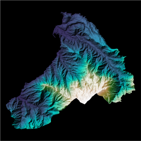
Final result
After merging all the tiles, I extracted each municipality.
The figure shows Agaete (northwest of Gran Canaria) with a hill-shading plot.