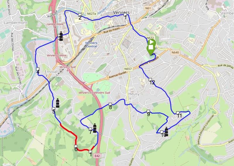
Grand Jogging de Verviers
30 June 2017
Leaflet
Grand Jogging de Verviers
The Jogging is probably the most popular sport event in the area, hence (maybe) it deserves a modern, interactive map with the location of the supplying stops. Or you might prefer the old-school map.

Here is how we prepare it.
Modules
- leaflet-omnivore to parse the coordinates from the GPX file,
- leaflet-distance-marker to add markers every kilometer,
- leaflet.awesome-markers- for the start and finish locations.
Data source
The track has been acquired by a Suntoo Ambit 3 device on June 18, 2017 (the day of the race). The file has been exported from Movescount interface in GPX format. The total distance measured was slightly under 13 km.
Processing
No processing was applied to the coordinates. An auxiliary track was created with only the coordinates corresponding to the Grand Prix de la Montagne (GPM) and then overlapped on the complete track.